Property Record
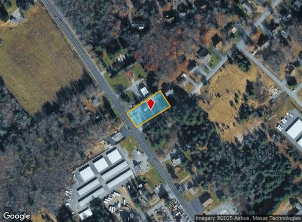
5750 Route 115, Blakeslee, PA 18610
NEARBY LISTINGS FOR SALE OR LEASE
-
-
View all Blakeslee listings for lease on LoopNet.com
Property Detail
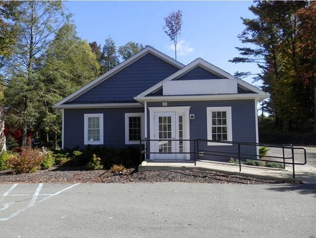
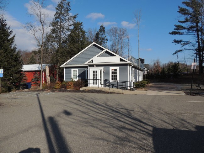
5750 Route 115
Officebuilding
Monroe
X
Pennsylvania
42089C0205E
0.56 AC
2025
Monroe County
2025
Philadelphia
300315
East Stroudsburg, PA
3,726 SF
19.19B.1.5
DEMOGRAPHICS near 5750 Route 115
1 Mile
3 Mile
5 Mile
2024 Total Population
386
1,558
4,978
2029 Population
345
1,440
4,873
Pop Growth 2024-2029
(10.62%)
(7.57%)
(2.11%)
Average Age
47
47
48
2024 Total Households
166
687
2,211
HH Growth 2024-2029
(10.84%)
(7.42%)
(2.26%)
Median Household Inc
$107,911
$92,879
$73,206
Avg Household Size
2.30
2.20
2.20
2024 Avg HH Vehicles
2.00
2.00
2.00
Median Home Value
$229,729
$233,333
$187,965
Median Year Built
1981
1982
1982
Nearby Places
Map Layers
Map Styles
 Street
 Aerial
- Restaurants
- Banks
- Shops
- Fitness
- Groceries
PUBLIC TRANSPORTATION
AIRPORT
Wilkes-Barre/Scranton International
DRIVE
WALK
Distance
Wilkes-Barre/Scranton International
41 min
26.7 mi
Freight Ports
Maher Terminal
DRIVE
WALK
Distance
Maher Terminal
120 min
95.4 mi
SALE & LEASE HISTORY
LISTING DATE
SALE/LEASE

Sep 25, 2016
For Lease
Sep 23, 2016
For Sale
Nov 23, 2020
For Lease
Nov 23, 2020
For Sale
May 11, 2017
For Lease
Mar 15, 2017
For Sale
Nearby Properties
Address
Land Use
TOTAL SIZE
Lot Size
Zoning
Address
Land Use
TOTAL SIZE
Lot Size
Zoning
1,003,800 SF
207.10 AC
CI
Address
Land Use
TOTAL SIZE
Lot Size
Zoning
510,410 SF
65.97 AC
CI
Address
Land Use
TOTAL SIZE
Lot Size
Zoning
65,104 SF
35.73 AC
C
Address
Land Use
TOTAL SIZE
Lot Size
Zoning
28,000 SF
7.12 AC
C
Address
Land Use
TOTAL SIZE
Lot Size
Zoning
720 SF
401.70 AC
RR
Address
Land Use
TOTAL SIZE
Lot Size
Zoning
48,196 SF
4.39 AC
CI
Address
Land Use
TOTAL SIZE
Lot Size
Zoning
36.60 AC
Address
Land Use
TOTAL SIZE
Lot Size
Zoning
5,712 SF
2.82 AC
C
Address
Land Use
TOTAL SIZE
Lot Size
Zoning
12,589 SF
4.05 AC
C
Address
Land Use
TOTAL SIZE
Lot Size
Zoning
3,282 SF
19.45 AC
C
Address
Land Use
TOTAL SIZE
Lot Size
Zoning
7,462 SF
4.55 AC
CI
Address
Land Use
TOTAL SIZE
Lot Size
Zoning
1,296 SF
245.49 AC
Address
Land Use
TOTAL SIZE
Lot Size
Zoning
10,107 SF
0.35 AC
C
Address
Land Use
TOTAL SIZE
Lot Size
Zoning
7,124 SF
3.87 AC
CI
Address
Land Use
TOTAL SIZE
Lot Size
Zoning
424.99 AC
OS
Address
Land Use
TOTAL SIZE
Lot Size
Zoning
2,872 SF
0.61 AC
C
Address
Land Use
TOTAL SIZE
Lot Size
Zoning
6,672 SF
13.38 AC
C-2
Address
Land Use
TOTAL SIZE
Lot Size
Zoning
438.14 AC
OS
Address
Land Use
TOTAL SIZE
Lot Size
Zoning
3,000 SF
1.17 AC
C-2
Address
Land Use
TOTAL SIZE
Lot Size
Zoning
40.90 AC
Address
Land Use
TOTAL SIZE
Lot Size
Zoning
100 SF
2.30 AC
C
Address
Land Use
TOTAL SIZE
Lot Size
Zoning
Address
Land Use
TOTAL SIZE
Lot Size
Zoning
9,687 SF
20.81 AC
Address
Land Use
TOTAL SIZE
Lot Size
Zoning
312.19 AC
OS
Address
Land Use
TOTAL SIZE
Lot Size
Zoning
10,748 SF
3.01 AC
CI
Address
Land Use
TOTAL SIZE
Lot Size
Zoning
13,880 SF
0.94 AC
C
Address
Land Use
TOTAL SIZE
Lot Size
Zoning
7,358 SF
2.32 AC
C
Address
Land Use
TOTAL SIZE
Lot Size
Zoning
87.01 AC
R-2
Address
Land Use
TOTAL SIZE
Lot Size
Zoning
12,632 SF
3 AC
CI
Address
Land Use
TOTAL SIZE
Lot Size
Zoning
7,905 SF
1.93 AC
C
The World's #1 Commercial Real Estate Marketplace
Connect with us
© 2025 CoStar Group
The information above has been obtained from sources believed reliable. While we do not doubt its accuracy we have not verified it and make no guarantee, warranty or representation about it. It is your responsibility to independently confirm its accuracy and completeness. Any projections, opinions, assumptions, or estimates used are for example only and do not represent the current or future performance of the property. The value of this transaction to you depends on tax and other factors which should be evaluated by your tax, financial, and legal advisors. You and your advisors should conduct a careful, independent investigation of the property to determine to your satisfaction the suitability of the property for your needs.